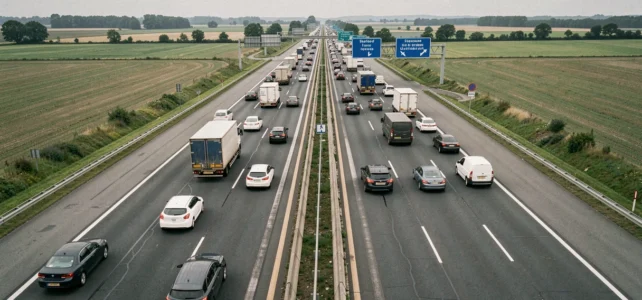
In 2025, 162 people died on French highways, according to the ASFA safety report published on July 29, 2026. This figure marks an increase compared to 2024 and reignites the debate on the actual danger of these routes. Talking about dangerous highways implies defining what is being measured: the raw number of fatalities, the accident rate per kilometer traveled, or the frequency of serious collisions on a given stretch.
Why highway mortality is on the rise in 2025
Highways remain, relative to the kilometers traveled, the safest network in France. National and departmental roads account for the majority of fatalities. This statistical reality does not prevent a worrying trend: highway mortality increased by about 26% in 2025 compared to the previous year, according to data reported by Caradisiac and Auto Moto.
The ASFA report highlights a significantly rising factor: inattention while driving. Smartphone use, GPS manipulation, and engagement with onboard screens. These behaviors, difficult to sanction in real-time, explain an increasing share of fatal accidents on highways.
A ranking of accident-prone highways does not limit itself to identifying a route or a road number. The danger of a stretch depends as much on its configuration as on the behavior of those who use it.
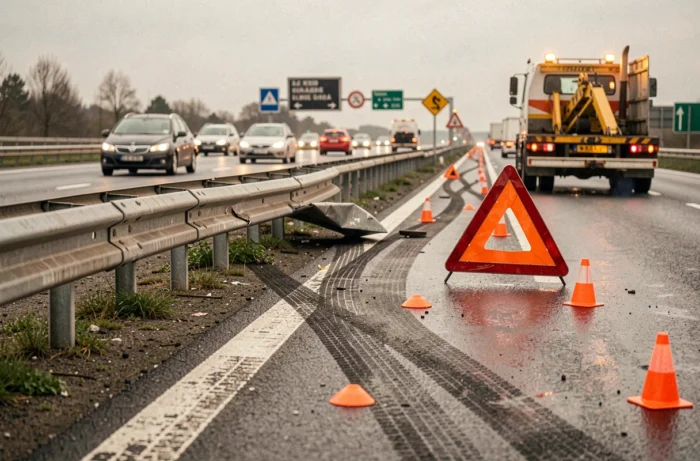
Accident-prone highways in France: what the raw numbers don’t reveal
Ranking the most dangerous highways by the number of raw accidents mechanically favors the most frequented routes. A highway that carries hundreds of thousands of vehicles per day will logically show more collisions than a little-used rural stretch.
The fatality rate per billion kilometers traveled provides a more nuanced view of the actual risk. This ratio relates the severity of accidents to traffic volume. A short but winding route, with poorly designed interchanges, can have a rate much higher than that of a heavily trafficked but newer and well-equipped highway.
Factors that increase risk on a stretch
Several design and operational elements impact the accident statistics of a highway:
- The presence or absence of a continuous emergency stopping lane, which conditions the severity of breakdowns and unexpected stops
- The profile of the layout (tight curves, elevation changes, recurrent fog zones) that reduces visibility and extends braking distances
- The density of exchange points (close entries and exits), which multiplies merging maneuvers and trajectory conflicts
- The condition of the pavement and drainage, which directly affects grip in rainy weather
Routes built before the 1980s often have less favorable geometric characteristics than more recent layouts. Narrow lane widths, tight central reservations, and older guardrails: these cumulative elements increase the severity of collisions.
Inattention and speed: the two dominant causes on highways
The ASFA 2025 report confirms that inattention has become the leading factor in fatal accidents on highways, ahead of excessive speed. The monotony of highway driving encourages a relaxation of attention, and the omnipresence of screens in the cabin amplifies the phenomenon.
Speed remains a major aggravating factor. At 130 km/h, the braking distance on dry pavement far exceeds what most drivers intuitively estimate. On wet pavement, this distance can double.
Motorcycle lane splitting: a recent parameter
Since January 11, 2025, motorcycle lane splitting has been permanently authorized on highways and certain fast lanes with separated roadways, under decree No. 2025-33 of January 9, 2025. This regulatory framework sets precise rules regarding the maximum speed and size of the vehicles involved.
This evolution concretely changes interactions between users on the busiest highways. Drivers must now account for the regular presence of two-wheelers between lanes, which adds an additional vigilance parameter, particularly in slow-down zones.

National roads and highways: comparing risk levels
Contents that list the most dangerous roads in France often mix highways, national roads, and departmental roads. National road 79, between Montmarault and Mâcon, is frequently cited as one of the deadliest in the country. Its two-lane sections, which complicate overtaking, are nothing like the traffic conditions on a toll highway.
Comparing a national road to a highway without specifying the type of road skews the analysis. Highways with separated roadways, controlled access, and no at-grade crossings provide a structurally more protective framework. The risk of a fatal accident per kilometer remains several times lower than that of two-way roads.
This distinction allows for a more nuanced view of alarming rankings. A highway may show a high number of accidents in absolute terms while remaining statistically safer than a poorly maintained departmental road traveled at 80 km/h.
The rise in highway mortality in 2025 does not challenge this hierarchy. It signals a behavioral problem (inattention, speed) rather than a widespread infrastructure deficiency. Recent, well-maintained, and properly signposted routes remain the safest in the French network, provided that drivers maintain their vigilance.